

Snow may all look the same from a distance, but up close it’s anything but. A foot of snow in the Cascades behaves nothing like a foot of snow in the Rockies, or the plains of Nebraska, or the Alaskan interior. Density, moisture content, and how the snowpack settles over a season all shift depending on climate, elevation, and geography.
Here’s a quick overview of the 6 different snow classes, why finding your proper snow class matters, and a new interactive tool we developed for you to find yours.
The 6 Snow Classes
There are 6 recognized snow classifications, each representing a distinct set of typical snowpack conditions:
-
Alpine: NSIDC “Montane Forest”. Mid-latitude mountain snow—cold, moderately deep, layered snowpack. The most common class across the western U.S. mountains.
-
Maritime: Coastal- or lake-influenced snow—relatively warm, wet, dense, deep snowpack (Cascades, Sierra Nevada, coastal ranges, Great Lakes snowbelts).
-
Prairie: Open grassland/plains snow—cold, windy, modest snowfall; thin wind-drifted snowpack (Great Plains, Canadian Prairies, intermountain basins).
-
Tundra: Arctic and far-northern snow—frigid, windy, treeless; thin, hard, wind-packed snowpack. Interchangeable with Taiga in the SNOdar app.
-
Taiga: NSIDC “Boreal Forest”. Very cold, calm, forested regions—low-density snowpack with depth hoar. Note: many high-altitude Rocky Mountain sites classify as Taiga, not Alpine.
-
Ephemeral: Transient snow in mild regions—shallow snow that typically melts within days. Requires SNOdar firmware/app v1.4.0+; on earlier versions select Maritime as the closest proxy.
The right classification depends on your specific site, not just the general region you’re in. Elevation and local microclimate can shift which class actually fits, even within the same state or province.
New to SNOdar? Learn more & check out the specs here.
Why Getting It Wrong Is a Problem
Misclassifying your site doesn’t cause an obvious, immediate problem. Everything still runs, data still comes in, it just isn’t matched to the conditions it’s actually measuring. Over a season, that mismatch can compound, especially for networks feeding data into forecasting models, road condition monitoring, or water resource planning, where consistency and reliability matter as much as any single reading.
For anyone managing a snow monitoring network, whether it’s a single site or a distributed system, this is a setup step worth getting right the first time, not something to revisit mid-season.
If you’re still deciding which sensor fits your monitoring needs in the first place, our snow depth sensor buyer’s guide walks through the key considerations.
Introducing the Snow Class Selector
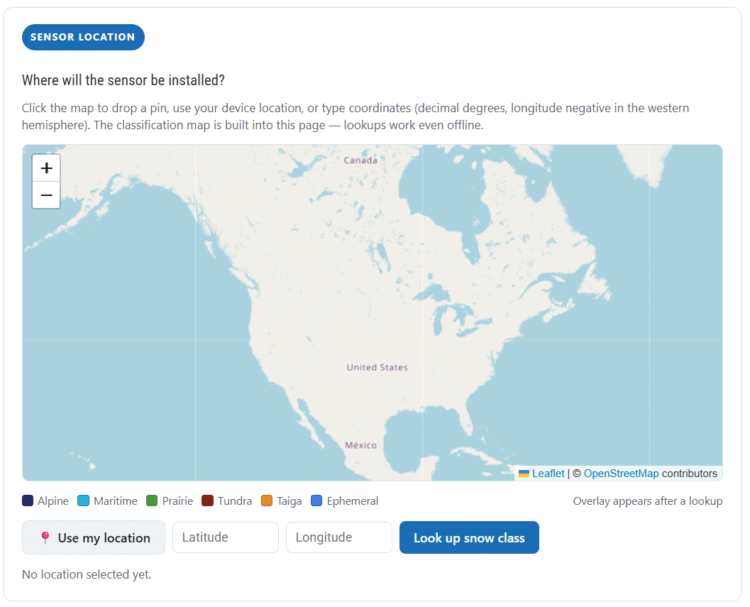
Instead of guessing or relying on general regional assumptions, we created a Snow Class Selector to tell you which snow class you fall under. Drop a pin directly on your site, use your device’s current location, or enter coordinates manually, and get a snow class recommendation based on your exact location.
The tool runs on a classification map built directly into the page, pulled from the revised global Seasonal Snow Climate Classification System (Sturm and Liston, 2021, Journal of Hydrometeorology), covering North America at 1 kilometer resolution and Eurasia at 5 kilometers. Because the map is embedded in the page itself, lookups still work even without an internet connection once the page has loaded.
Each of the 6 classes has its own color on the map, so you can see roughly which class dominates your region and where nearby boundaries fall.
What the Results Show You
Once you run a lookup, you’ll see:
- Your snow class, along with the name that class goes by in the underlying NSIDC dataset (the naming doesn’t always match exactly, more on that below)
- The exact setting to select on the SNOdar app’s Snow Class page
- What percentage of nearby classified cells, within about 10 kilometers, share that same classification, useful context for how consistent or mixed the surrounding terrain is
- A boundary alert if your site sits close to a class transition, so you can double check your pin placement before finalizing setup
- The three nearest SNOTEL reference stations, with their distance and their own classification, giving you a real-world cross-check against established monitoring sites
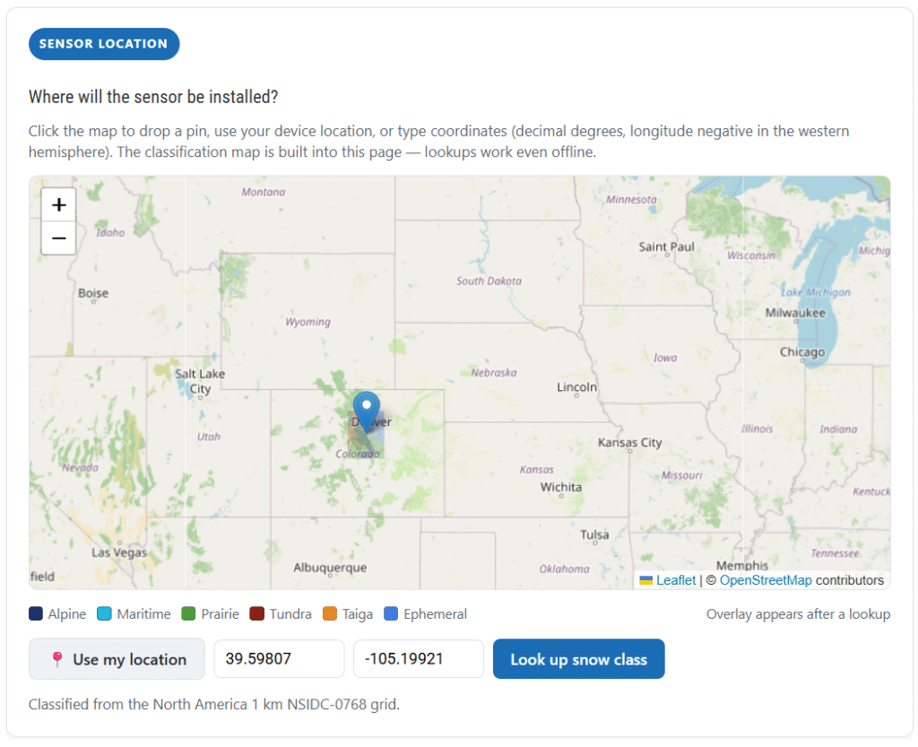
Snow Class Selector map interface showing color-coded snow classes and pin location
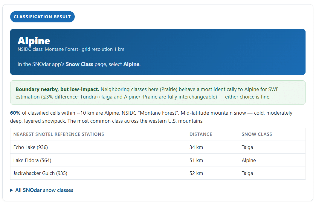
Snow Class Selector result showing an Alpine classification with nearby SNOTEL reference stations
Naming Isn’t Always a One-to-One Match
One detail worth knowing before you use the tool: Our class names don’t map perfectly onto NSIDC’s original naming. Two specific translations to keep in mind:
- NSIDC’s “Montane Forest” becomes Alpine in SNOdar
- NSIDC’s “Boreal Forest” becomes Taiga in SNOdar
If you’re cross-referencing NSIDC data or research elsewhere, keep that translation in mind so the naming doesn’t throw you off.
Expect a Few Surprises
Not every result matches intuition. A site can sit somewhere you’d expect to classify one way and come back entirely different once the underlying data is applied. When that happens, it’s worth reading the class description rather than second-guessing the result. A cold, windy, thin, wind-drifted snowpack points to Prairie, for example, even in a location you wouldn’t immediately associate with plains-style snow. Once you read the description, the reasoning behind an unexpected classification usually becomes clear fast.
Getting your snow monitoring setup right before the season starts is a lot easier than troubleshooting it in the middle of a storm. The Snow Class Selector is one small step that makes a real difference when it matters most.